
3D and 2D campus map · Northridge, California
California State University, Northridge (CSUN) Campus Map
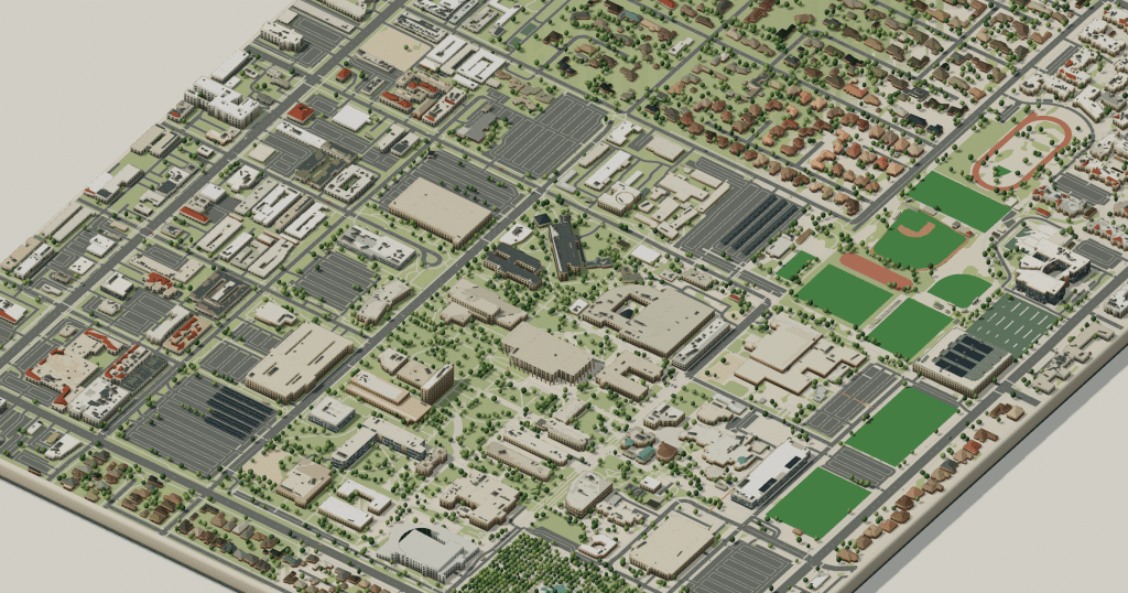
Rotate the campus, zoom in on any building and click it to see what is inside.
- Drag to orbit
- Scroll or pinch to zoom
- Click a building for details
- Right-drag to pan

Jump to a building
Pick a building to fly the map to it and open its departments and services. Every place at California State University, Northridge is also searchable from the map itself.
California State University, Northridge
Campus directory
Faculties, departments, libraries and services across the campus. Pick one and the map takes you there, in 3D or 2D.
No matching places. Try another name.
About this map
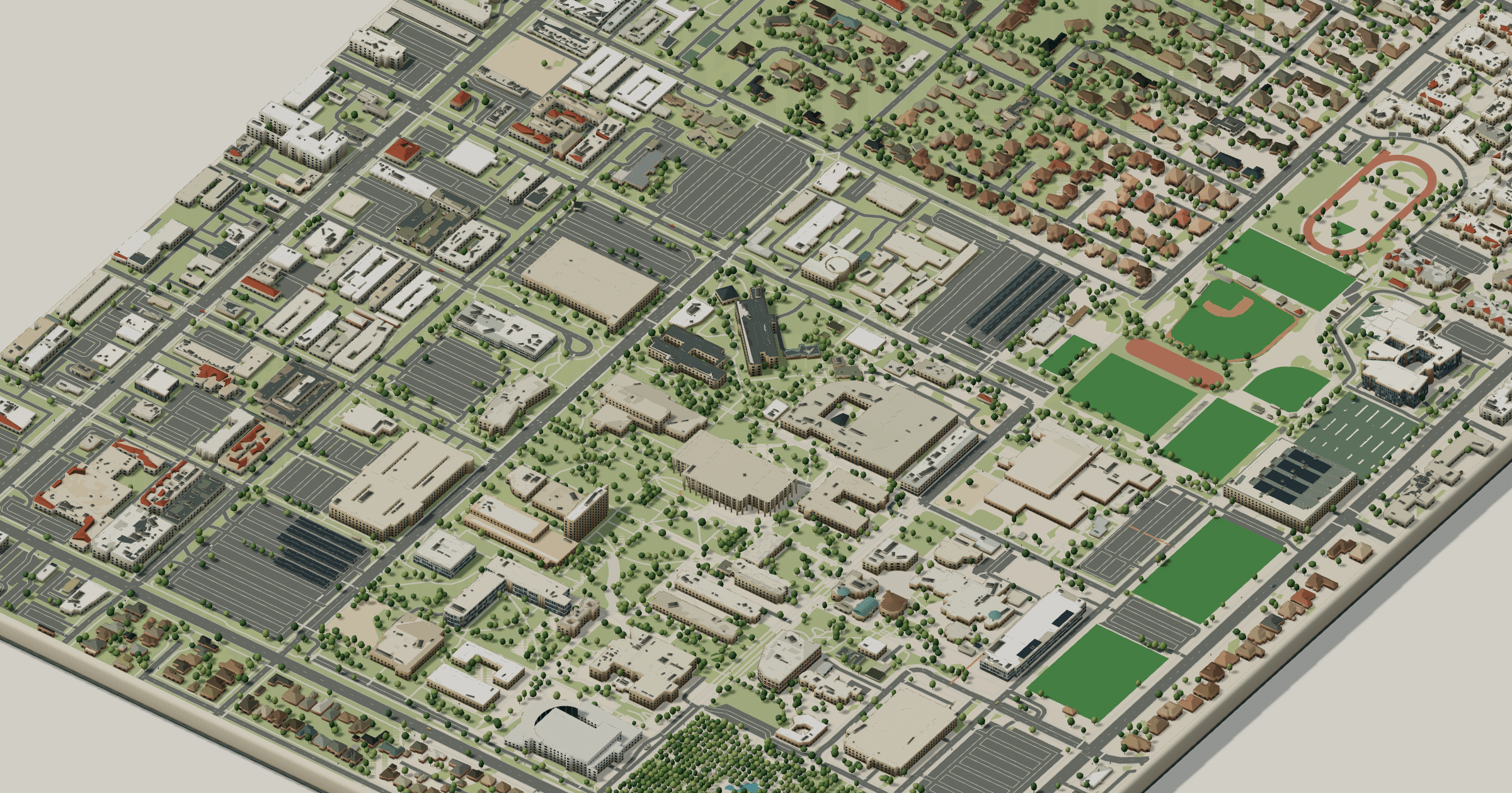
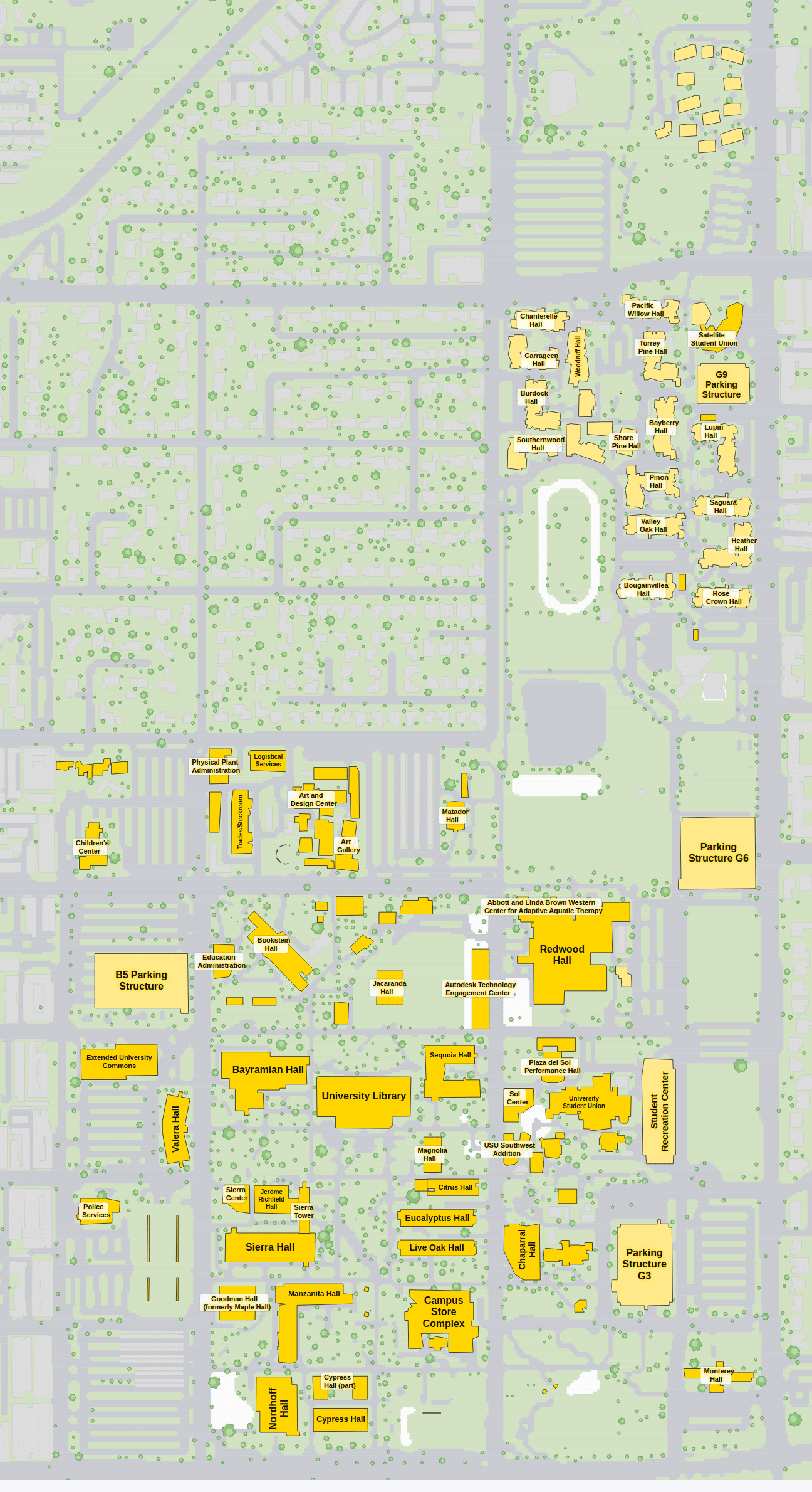
The Oviatt Library and its reflecting pool are the natural starting point at California State University, Northridge. East of the library lawn you reach the University Student Union and the Valley Performing Arts Center; north are the science and engineering buildings, with the Orange Grove, the residence halls and the Matador fields further out. The 3D view shows how Sierra Quad and the library lawn open into each other, and the 2D version spells out every building name.
California State University, Northridge in 3D
California State University, Northridge 2D plan
More campus maps
- California Polytechnic State University, San Luis ObispoSan Luis Obispo, California
- California State University, FresnoFresno, California
- California State University, Long BeachLong Beach, California
- San José State UniversitySan José, California
- University of California, BerkeleyBerkeley, California
- University of California, RiversideRiverside, California
- University of California, San DiegoLa Jolla, California
- University of California, Santa CruzSanta Cruz, California
- Florida Atlantic UniversityBoca Raton, Florida
- Massachusetts Institute of TechnologyCambridge, Massachusetts
- The University of Texas at AustinAustin, Texas
- University of UtahSalt Lake City, Utah