
3D and 2D campus map · Tallahassee, Florida
Florida State University (FSU) Campus Map
Rotate the campus, zoom in on any building and click it to see what is inside.
- Drag to orbit
- Scroll or pinch to zoom
- Click a building for details
- Right-drag to pan

Jump to a building
Pick a building to fly the map to it and open its departments and services. Every place at Florida State University is also searchable from the map itself.
Florida State University
Campus directory
Faculties, departments, libraries and services across the campus. Pick one and the map takes you there, in 3D or 2D.
No matching places. Try another name.
About this map
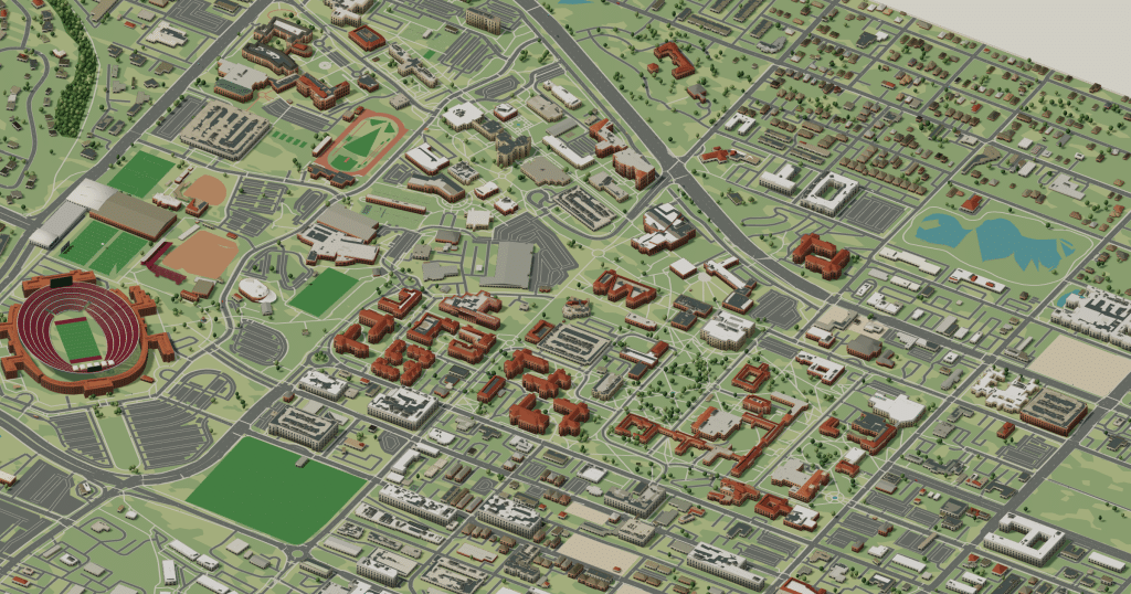
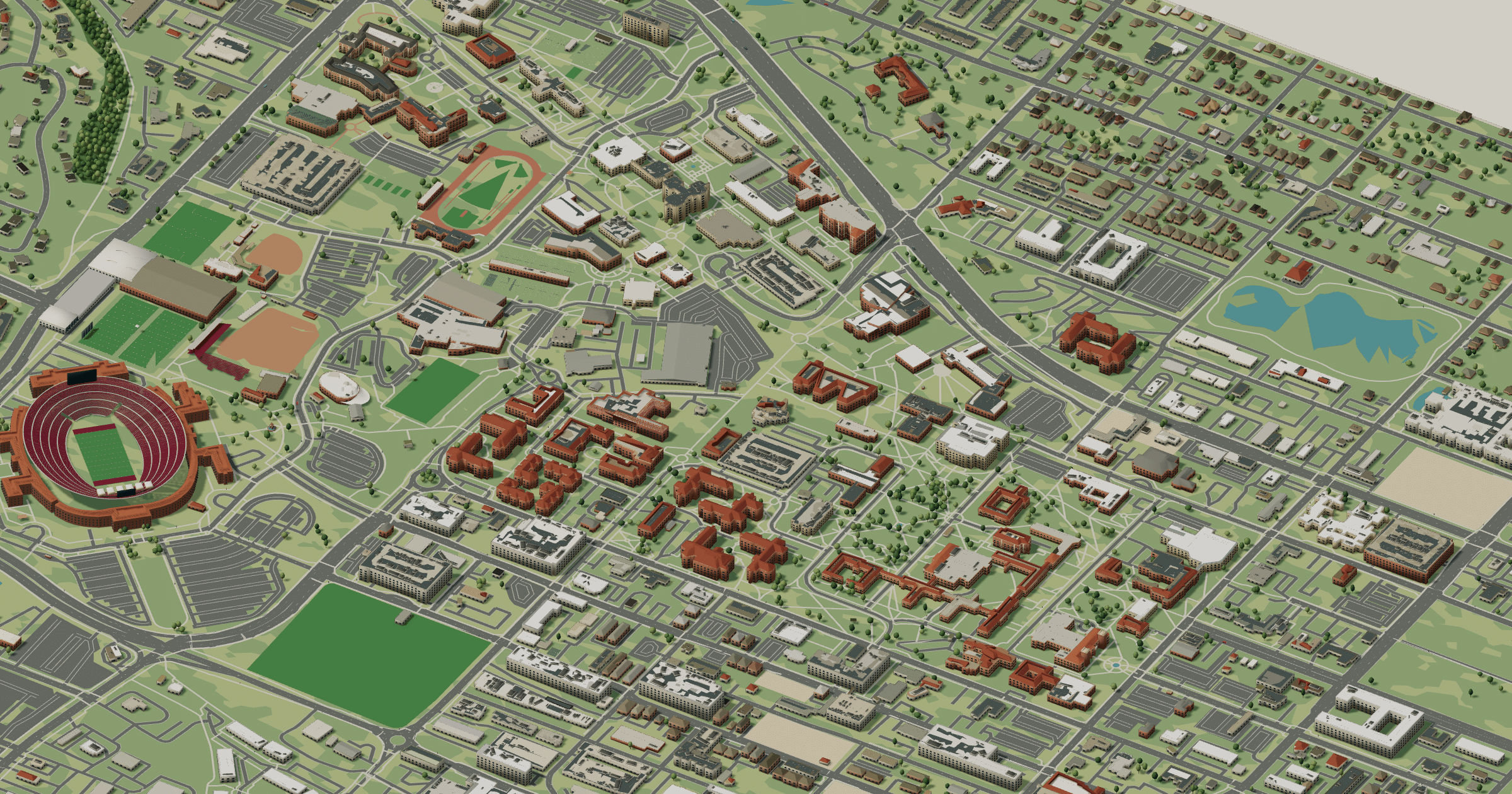
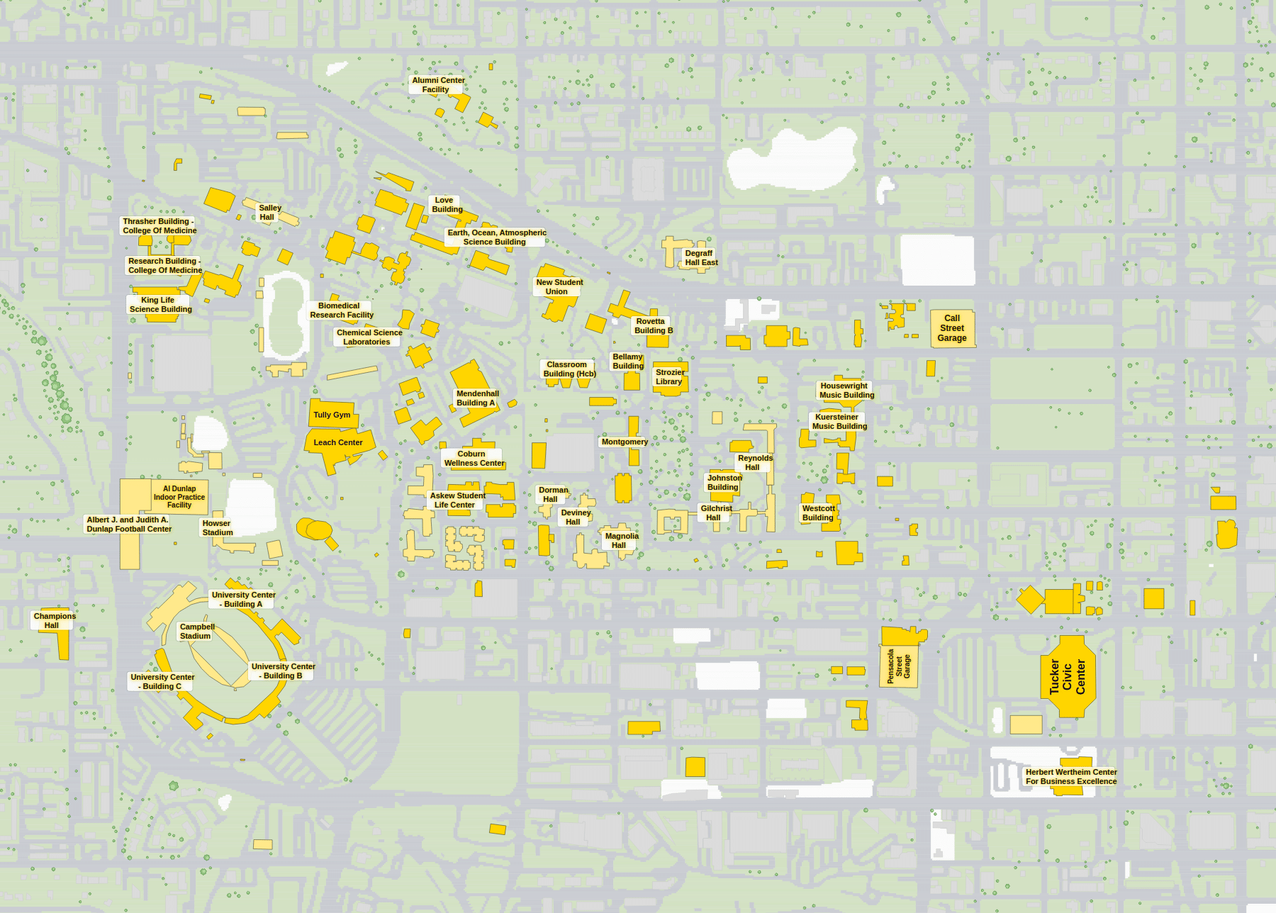
Florida State University’s red-brick Collegiate Gothic halls sit among live oaks in Tallahassee. The Westcott Building and its fountain mark the old entrance, Landis Green is framed by Strozier and Dirac libraries, the Student Union and the science quarter lie north, and Doak Campbell Stadium dominates the southwest. Admire the brick in 3D, and use the 2D plan whenever you need a specific classroom or garage.
Florida State University in 3D
Florida State University 2D plan
More campus maps
- Florida Atlantic UniversityBoca Raton, Florida
- University of Central FloridaOrlando, Florida
- University of FloridaGainesville, Florida
- University of South FloridaTampa, Florida
- California State University, Long BeachLong Beach, California
- Massachusetts Institute of TechnologyCambridge, Massachusetts
- Oregon State UniversityCorvallis, Oregon
- San José State UniversitySan José, California
- The University of Texas at AustinAustin, Texas
- University of California, BerkeleyBerkeley, California
- University of OregonEugene, Oregon
- University of UtahSalt Lake City, Utah